🎉 Up to 70% Off Selected ItemsShop Sale

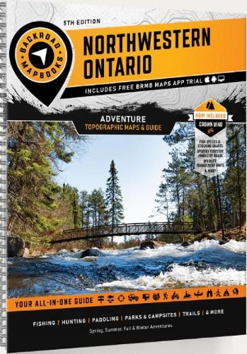
Northwestern Ontario Backroad Mapbook
Covering a sprawling wilderness landscape of interconnected lakes, rivers, canyons, hills, forests and wetland, Northwestern Ontario is a massive outdoor playground just waiting to be explored. From paddling to hiking, hunting, fishing, snowmobiling, ATVing, cross-country skiing, camping and more, there is no limit to outdoor activity in Northwestern Ontario. Covering the area around Thunder Bay and Atikokan in the south to the remote wilderness of Opasquia Provincial Park further north and all the way up to Hudson’s Bay, there are endless opportunities for adventure covered in this guidebook. This mapbook includes Chapleau, Cobalt, Cochrane, Elliot Lake, Foleyet, French River, Gogama, Gowganda, Hearst, Kapuskasing, Kirkland Lake, Manitoulin Island, Matchewan, Moosonee, North Bay, Sault Ste. Marie, Sudbury, Temagami, Temiskaming Shores, Timmins, Wawa, and more Highways, Logging Roads, Crown Land, Land and Water Features, Parks, Adventure Points of Interest, Campgrounds, Hiking Trails, Motorized Trails, Paddling Routes, Hunting and Fishing Areas, Winter Recreation and more
$10.71
Original: $30.59
-65%Northwestern Ontario Backroad Mapbook—
$30.59
$10.71Northwestern Ontario Backroad Mapbook
Covering a sprawling wilderness landscape of interconnected lakes, rivers, canyons, hills, forests and wetland, Northwestern Ontario is a massive outdoor playground just waiting to be explored. From paddling to hiking, hunting, fishing, snowmobiling, ATVing, cross-country skiing, camping and more, there is no limit to outdoor activity in Northwestern Ontario. Covering the area around Thunder Bay and Atikokan in the south to the remote wilderness of Opasquia Provincial Park further north and all the way up to Hudson’s Bay, there are endless opportunities for adventure covered in this guidebook. This mapbook includes Chapleau, Cobalt, Cochrane, Elliot Lake, Foleyet, French River, Gogama, Gowganda, Hearst, Kapuskasing, Kirkland Lake, Manitoulin Island, Matchewan, Moosonee, North Bay, Sault Ste. Marie, Sudbury, Temagami, Temiskaming Shores, Timmins, Wawa, and more Highways, Logging Roads, Crown Land, Land and Water Features, Parks, Adventure Points of Interest, Campgrounds, Hiking Trails, Motorized Trails, Paddling Routes, Hunting and Fishing Areas, Winter Recreation and more
Product Information
Product Information
Shipping & Returns
Shipping & Returns
Description
Covering a sprawling wilderness landscape of interconnected lakes, rivers, canyons, hills, forests and wetland, Northwestern Ontario is a massive outdoor playground just waiting to be explored. From paddling to hiking, hunting, fishing, snowmobiling, ATVing, cross-country skiing, camping and more, there is no limit to outdoor activity in Northwestern Ontario. Covering the area around Thunder Bay and Atikokan in the south to the remote wilderness of Opasquia Provincial Park further north and all the way up to Hudson’s Bay, there are endless opportunities for adventure covered in this guidebook. This mapbook includes Chapleau, Cobalt, Cochrane, Elliot Lake, Foleyet, French River, Gogama, Gowganda, Hearst, Kapuskasing, Kirkland Lake, Manitoulin Island, Matchewan, Moosonee, North Bay, Sault Ste. Marie, Sudbury, Temagami, Temiskaming Shores, Timmins, Wawa, and more Highways, Logging Roads, Crown Land, Land and Water Features, Parks, Adventure Points of Interest, Campgrounds, Hiking Trails, Motorized Trails, Paddling Routes, Hunting and Fishing Areas, Winter Recreation and more