🎉 Up to 70% Off Selected ItemsShop Sale

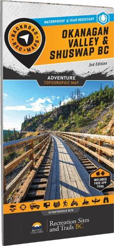
Okanangan Valley Shuswap BC
From the sun-soaked ridges of the South Okanagan to the snow-laden slopes of the Monashees, this map is made for those who don't just pass through - they truly dig in. Designed with real use in mind and packed with intricate details, it's your trusted companion for fishing alpine lakes, paddling pristine rivers, discovering remote recreation sites, or tearing through ATV and sled trails. Whether you're hunting, camping, fishing, or blazing the backroads, this map has your back. No signal? No problem. Just unfold it and keep exploring. - Durable Beyond Limits: Waterproof and tear-resistant to withstand rain, mud, snow, and the toughest adventures. - Rich in Detail: Includes trails, logging roads, stocked lakes, campgrounds, WMUs, and prime fishing spots. - GPS-Compatible: Seamlessly integrates with GPS devices and mobile apps for reliable navigation. MAP COVERAGE From Adams Lake to Armstrong, Enderby to Grand Forks, and Kelowna to Naramata, this map spans Oliver, Osoyoos, Penticton, Salmon Arm, Seymour Arm, Sicamous, Vernon, and all the rugged backroads and untamed terrain connecting them.
$8.08
Original: $23.09
-65%Okanangan Valley Shuswap BC—
$23.09
$8.08Okanangan Valley Shuswap BC
From the sun-soaked ridges of the South Okanagan to the snow-laden slopes of the Monashees, this map is made for those who don't just pass through - they truly dig in. Designed with real use in mind and packed with intricate details, it's your trusted companion for fishing alpine lakes, paddling pristine rivers, discovering remote recreation sites, or tearing through ATV and sled trails. Whether you're hunting, camping, fishing, or blazing the backroads, this map has your back. No signal? No problem. Just unfold it and keep exploring. - Durable Beyond Limits: Waterproof and tear-resistant to withstand rain, mud, snow, and the toughest adventures. - Rich in Detail: Includes trails, logging roads, stocked lakes, campgrounds, WMUs, and prime fishing spots. - GPS-Compatible: Seamlessly integrates with GPS devices and mobile apps for reliable navigation. MAP COVERAGE From Adams Lake to Armstrong, Enderby to Grand Forks, and Kelowna to Naramata, this map spans Oliver, Osoyoos, Penticton, Salmon Arm, Seymour Arm, Sicamous, Vernon, and all the rugged backroads and untamed terrain connecting them.
Product Information
Product Information
Shipping & Returns
Shipping & Returns
Description
From the sun-soaked ridges of the South Okanagan to the snow-laden slopes of the Monashees, this map is made for those who don't just pass through - they truly dig in. Designed with real use in mind and packed with intricate details, it's your trusted companion for fishing alpine lakes, paddling pristine rivers, discovering remote recreation sites, or tearing through ATV and sled trails. Whether you're hunting, camping, fishing, or blazing the backroads, this map has your back. No signal? No problem. Just unfold it and keep exploring. - Durable Beyond Limits: Waterproof and tear-resistant to withstand rain, mud, snow, and the toughest adventures. - Rich in Detail: Includes trails, logging roads, stocked lakes, campgrounds, WMUs, and prime fishing spots. - GPS-Compatible: Seamlessly integrates with GPS devices and mobile apps for reliable navigation. MAP COVERAGE From Adams Lake to Armstrong, Enderby to Grand Forks, and Kelowna to Naramata, this map spans Oliver, Osoyoos, Penticton, Salmon Arm, Seymour Arm, Sicamous, Vernon, and all the rugged backroads and untamed terrain connecting them.